
New AI Tool Creates Realistic Satellite Images of Future Flooding
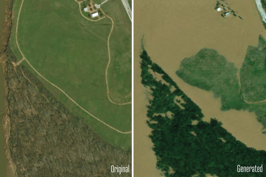
In recent years, the increasing frequency and intensity of flooding events have underscored the need for advanced predictive tools to aid in disaster preparedness and response. A groundbreaking development in this field is the creation of an AI tool capable of generating realistic satellite images of future flooding scenarios.
Development of the AI Tool
The AI tool, developed by scientists at the Massachusetts Institute of Technology (MIT), represents a significant advancement in the use of artificial intelligence for environmental monitoring and disaster preparedness. The tool, known as the "Earth Intelligence Engine," combines generative artificial intelligence (AI) with a physics-based flood model to produce realistic, birds-eye-view images of regions likely to be affected by flooding.